

To walk the ridge between Lostwithiel and Tywardreath is to trace the final collapse of Parliament’s western campaign in 1644. The hedged fields and wooded valleys that now seem so peaceful once funnelled thousands of exhausted infantry toward Castle Dore, the ancient hillfort that became the last defensible ground before surrender. The battle of Lostwithiel, fought in two phases across late August and early September, was Parliament’s worst defeat of the Civil War. And Castle Dore, long associated with Cornish legend, became the site of its final reckoning.
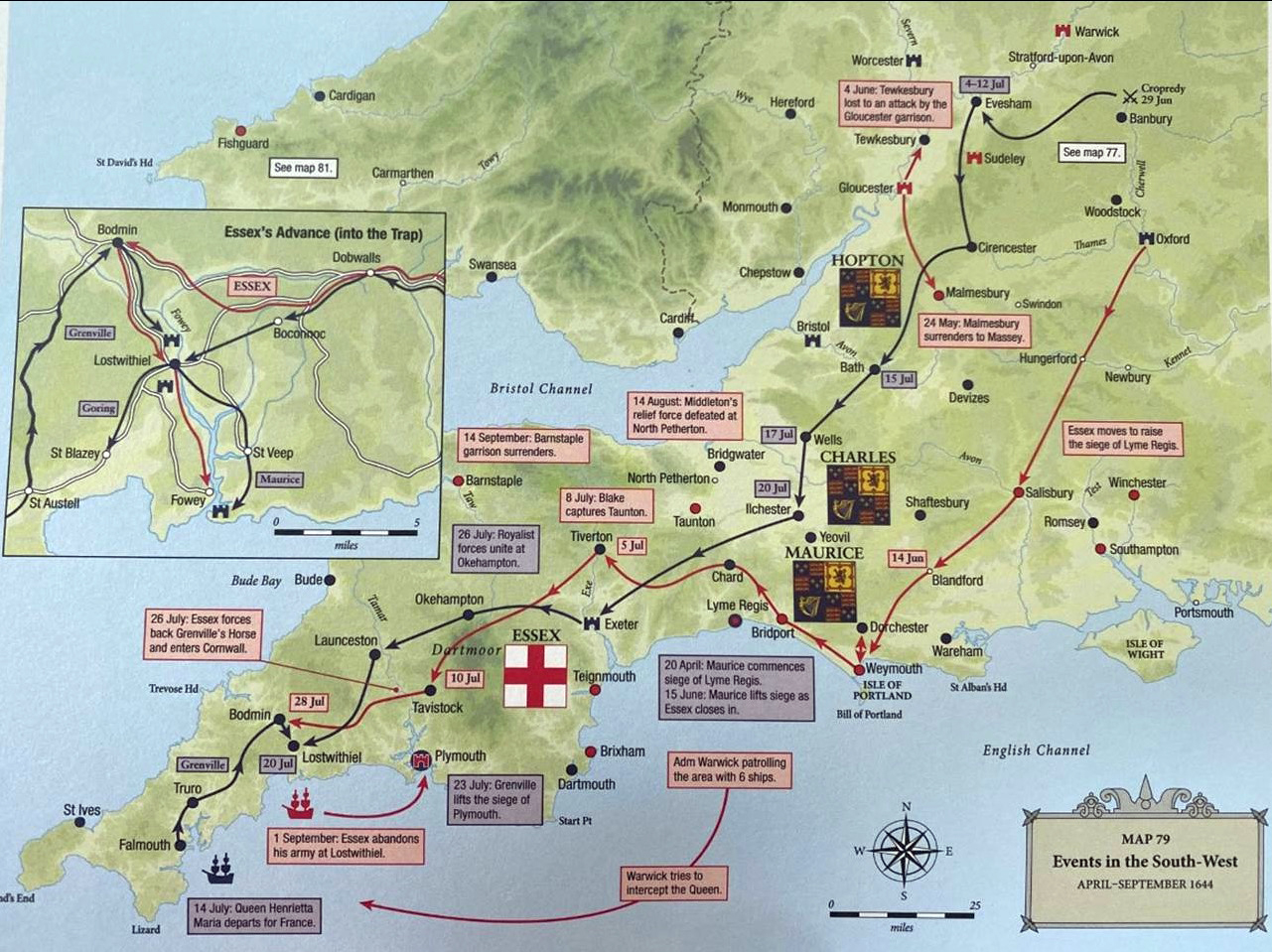
Essex had entered Cornwall in early August, hoping to relieve Plymouth and secure the south‑west. Encouraged by Lord Robartes’ assurances of local support, he advanced as far as Lostwithiel and secured the port of Fowey, intending to link up with Warwick’s fleet. But the King, having defeated Waller at Cropredy, now marched west with the Oxford army. By 11 August, Charles, Maurice and Grenville had converged on Lostwithiel, surrounding Essex’s force of some 9,000 men. The terrain worked against Parliament: the River Fowey to the east and the River Par to the west hemmed in Essex’s position, leaving only the sea as a possible escape route.
The first phase of fighting began on 21 August. Royalist forces seized the high ground north and east of Lostwithiel — Restormel Castle, Beacon Hill, and Druid Hill — forcing Essex into a tighter pocket. Skirmishes followed, but the decisive action came ten days later. On 31 August, Essex ordered his cavalry to break out toward Plymouth under cover of darkness. They succeeded. But the infantry, left behind, began a retreat south toward Fowey, hoping to reach the fleet. The Royalists pursued immediately, driving the Parliamentarians through the narrow lanes and enclosed fields that run between Lostwithiel and the coast.
The battlefield map makes the nature of this pursuit unmistakably clear. Royalist units under Grenville, Maurice, Bassett, Blagge, Northampton and the Lifeguards pressed down from the north and east in a tightening arc. Their movements, shown on the map as blue blocks sweeping southward from St Blazey, Cliffe and the high ground above Lostwithiel, reveal a deliberate attempt to compress the Parliamentarian retreat into the narrowest possible corridor. Meanwhile, Parliamentarian formations under Skippon, Robartes, Fortescue, Aldrich, Davies and the two small troops of Plymouth horse attempted to hold successive defensive lines, each one marked in red as they fell back toward Tywardreath and the ridge of Castle Dore.
The terrain narrowed their options. The modern B3269 traces the route of the retreat, but in 1644 it was a series of sunken lanes and field paths, bordered by steep hedges and wooded slopes. The map shows how the Royalists exploited this geography: Grenville’s infantry pushed along the eastern flank toward Tywardreath, while Maurice and Bassett advanced from the north, forcing the Parliamentarians into a shrinking wedge between the rivers. Blagge’s men, moving from the direction of St Blazey and the old shoreline, severed any hope of escape toward Par. With the River Fowey, Penpoll Creek and the inlets near Golant closing off their eastern flank, the Parliamentarian line, already weakened by desertion and exhaustion, simply could not absorb pressure from so many converging directions.
By evening, the Parliamentarian infantry had reached the ridge crowned by Castle Dore. The ancient hillfort, with its concentric earthworks and commanding views, offered a natural defensive position. It had stood for over two thousand years, first as an Iron Age settlement and at least until the late Roman period if not later than that. Now, in 1644, it became the final refuge of Essex’s abandoned foot soldiers. Skippon attempted to rally his men here, but the Royalists had already encircled the ridge. On the map, the blue blocks around Castle Dore and Tywardreath show Grenville, Maurice, Bassett and the Lifeguards closing in on three sides, leaving only the steep descent toward Fowey still open — and even that choked with fugitives and abandoned equipment. The fighting subsided as night fell, and Essex himself fled by boat from the shore near Polkerris, leaving Skippon to negotiate terms.
On 2 September, the Parliamentarian infantry surrendered from Castle Dore. Around 6,000 men laid down their arms. They were marched east toward Southampton, suffering heavily from disease, exposure and attacks by hostile locals. As many as half died before reaching safety. The defeat at Lostwithiel secured the south‑west for the King and triggered major reforms in Parliament’s military command, including the Self‑Denying Ordinance and the creation of the New Model Army, out of which the later British Army — and its famous redcoats — would grow.
Castle Dore’s role in the battle was brief but decisive. It marked the point at which Essex’s army simply stopped functioning as a fighting force. The hillfort’s fame as the legendary stronghold of King Mark gives the place an added layer of interest, but in 1644 it served only as the last patch of high ground available to a retreating army. Today the site is quiet, its earthworks softened by grass and time, with nothing visible to hint at the chaos of that final night. Yet when set against the map of the campaign — with its tightening ring of Royalist units and the narrow corridor down which the Parliamentarians were driven — it becomes clear why the army ended up here, and why it could go no further.


