

Kilmington’s story begins with its position on one of the oldest routeways in the Axe valley. The Roman Fosse Way passed through Axminster, and a second route from Charmouth towards Honiton crossed the landscape nearby. These roads shaped settlement patterns for centuries. Although no Roman structures are known within Kilmington itself, the strategic importance of Axminster as a river and road crossing is well established and explains the early coherence of the surrounding parishes.
After the Roman withdrawal, the area became part of the developing West Saxon kingdom. By the time of the Domesday survey in 1086, Kilmington was held directly by King William and formed part of the Hundred of Axminster. The Hundred’s boundaries, including its well‑known anomalies with Dalwood, Stockland and Thorncombe, are securely documented and show how administrative geography in this corner of Devon evolved over time.
The earliest firm reference to Kilmington church appears in 1288. By then, major religious houses had become significant landholders in the Axe valley. Forde Abbey and Newenham Abbey both held property and rights in the parish, and their surviving charters provide some of the clearest medieval evidence for Kilmington. Field names, farm names and small tenurial transactions begin to appear in the 13th and 14th centuries, giving us the first detailed glimpses of the medieval landscape.
The Black Death reached the Axe valley in 1348–49. Newenham Abbey’s records describe catastrophic losses among monks and servants, and although Kilmington’s own figures are not preserved, the impact on the wider district is beyond doubt. Later medieval references include routine manorial business, land transfers and occasional disputes, but the surviving material is fragmentary.
The 16th century brings firmer ground. Newenham Abbey was dissolved in 1539, and parish accounts from the mid‑1500s survive in detail. These records show the practical life of the village: payments for church repairs, poor relief, local obligations, and the maintenance of roads and boundaries. They also reveal the parish’s continuing links with Axminster, which remained the administrative and ecclesiastical centre for the district.
The 17th century brought national conflict into the area. In 1644 Axminster served as a Royalist base during the Civil War, and contemporary accounts describe troop movements through the surrounding parishes, including Kilmington. Monmouth’s rising in 1685 drew support from East Devon and West Dorset, and the subsequent Assizes affected families across the region.
Nonconformity has deep and well‑documented roots here. A Baptist congregation existed in Kilmington by the early 17th century and later centred on Loughwood Chapel, one of the most important surviving dissenting sites in the South West. Its records provide a parallel narrative to the established church and show the strength of religious independence in the area.
From the 18th century onwards, the documentary record becomes increasingly rich. The Axminster–Honiton turnpike followed the line of the old Roman road. Thomas Whitty founded the Axminster carpet factory in 1755, bringing national attention to the district. The Seaton landslip of 1839 is extensively recorded and remains one of the most dramatic geological events in local history. The formation of the Axminster Union in the 1830s and 1840s replaced the old Hundred structure, and the arrival of the railway in 1860 (and later to Seaton in 1868) transformed travel and trade.
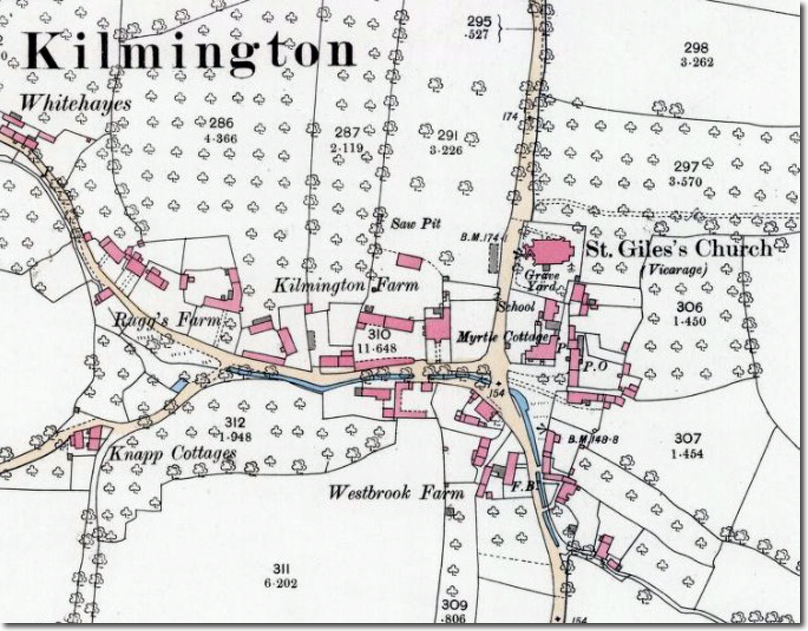
Kilmington’s school was rebuilt in 1867, using stone from the earlier building, under arrangements clearly preserved in parish documentation. By the late 19th century, maps, directories and parish records provide a detailed picture of the village: its farms, trades, chapels, and the gradual shaping of the modern settlement.

