

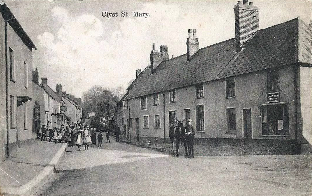
Clyst St Mary stands on one of the oldest lines of communication in East Devon. The modern road through the village follows the course of a Roman route running east out of Isca Dumnoniorum (Exeter), a strategic corridor linking the fortress and later civitas with the coast. The settlement grew where this road met the River Clyst, a practical crossing point long before the medieval village took shape. The name itself, from the Celtic clyst meaning “clear stream”, preserves the older landscape in language.
The village appears in the Domesday Book as “Bishop’s Cliste”, reflecting its tenure under the bishops of Exeter. Its defining feature for most of its recorded history is the bridge over the River Clyst. First built in the late 12th century and rebuilt in 1310, it is the oldest surviving bridge in Devon. For centuries it carried the principal road between Exeter and London. Every royal courier, merchant convoy and military force travelling east from Exeter crossed those narrow arches. The bridge controlled movement in and out of the city, and its position on the Roman alignment made it a fixed point in the regional landscape long before the parish boundaries were drawn.
The medieval bridge was never a grand structure, but its importance was out of all proportion to its size. Its restricted width created a natural choke point, and its low arches were vulnerable to flooding, forcing travellers to wait on either bank. The bridge’s strategic value explains why so many historical events in East Devon converge on this one spot: it was the unavoidable crossing, the hinge between Exeter and the eastern counties.
The village developed in two clusters: one around the church and the Winslade House estate, and the other along the road leading to the bridge, where most of the houses, inns and businesses were located. Farms and small hamlets fill the surrounding parish, giving the area a dispersed rural character despite its proximity to Exeter.
Clyst St Mary’s most violent moment came during the Prayer Book Rebellion of 1549. After the Battle of Woodbury Common on 4 August, the rebel army under Humphrey Arundell regrouped at Clyst St Mary with roughly 6,000 men. On 5 August they were attacked by government forces under Sir William Francis, acting for John Russell, 1st Earl of Bedford. The fighting was brutal and close‑quarters, shaped by the confined ground around the bridge and the riverbanks. Around a thousand rebels were killed, many more captured, and some 900 prisoners were massacred later that day at Clyst Heath. The village was burned, and many of the dead — soldiers and civilians alike — drowned in the Clyst. The bridge dictated the course of events.
The parish church of St Mary, with medieval origins and later Victorian alterations, contains memorials to several notable local families. Among them are the Porchers of Winslade House and Edward Cotsford, whose monument records his service in the East Indies and later public offices.
Winslade House, the former manor, later became a school and was requisitioned during the Second World War. It formed part of the U.S. Navy’s supply network centred on the depot at Countess Wear (JOWL‑93). The grounds at Winslade Park were used as an open‑storage and logistics site by the 10th Naval Construction Battalion, the 25th Naval Construction Battalion, and the 10th Special Naval Construction Battalion — Seabees responsible for building and operating the infrastructure that supported the American build‑up to D‑Day.
Clyst St Mary Primary School, founded in the 1830s, remains one of the oldest institutions in the parish. Its catchment has long extended beyond the village itself, drawing pupils from Sowton, Farringdon and the surrounding farms.
The Roman road, the medieval bridge, the manor estate, the church and the events of 1549 form the core of Clyst St Mary’s historical identity. The village’s development has always been shaped by its position on a route used for nearly two thousand years and by the river crossing that made it a point no traveller could avoid.

