

Colonel Clarence Preston Gunter (1873–1965) was one of the most important figures in the transition from traditional ground survey to aerial cartography. A career officer of the Royal Engineers and later Director of the Survey of India, he combined technical brilliance with practical ingenuity, leaving a legacy that shaped both military operations and civil administration across the British Empire.
Born on 24 March 1873, the son of Colonel Howel Gunter of the Black Watch, Clarence was educated at Westward Ho! and King William’s College, Isle of Man, before entering the Royal Military Academy, Woolwich. Commissioned into the Royal Engineers in 1893, he trained at Chatham and was soon posted to India. His early career took him to Meerut, Dehra Dun, and Rawalpindi, though illness briefly forced his return to Britain. By 1898 he was back in India, serving in the Tirah Campaign as an Assistant Field Engineer. In December 1899 he joined the Survey of India at Dehra Dun, where he would remain for the rest of his service.
His early survey work carried him through Assam and Burma, and in 1911–12 he was one of two officers on the Mishmi Mission, tasked with improving communications through the North Eastern Province towards China. Promoted to Major in 1913, he became Deputy Superintendent of the Survey of India at Shillong, Assam. These formative years honed his skills in difficult terrain, preparing him for the challenges of war.
During the First World War, Gunter was placed in charge of the Map Compilation Section at Tigris Corps Headquarters in Mesopotamia. The campaign had begun disastrously, hampered by poor maps and inadequate geographical knowledge. Gunter’s energy and organisation transformed the situation. As the official War Record later noted, “it was due to his untiring energy that the Expeditionary Force in Mesopotamia was never again destitute of accurate maps for its operations.” In 1916 an Air-Photo Section was added to his command, and he was promoted to Lieutenant-Colonel. His innovations included the ingenious use of artillery shell bursts as control points in the flat Mesopotamian plains, and the systematic integration of aerial photography into mapping. He oversaw the creation of photographic mosaics, which were then corrected and converted into line-plans by trained surveyors on the ground, ensuring accuracy despite distortions caused by shadows or rooflines. He established practical limits of scale, concluding that reliable mapping required negatives at three inches to the mile or larger, and he demonstrated the speed of aerial methods with his Baghdad survey of 1917, compiled at twelve inches to the mile and completed in a fortnight. He also proved their economy, showing that mapping 9.2 square miles outside Baghdad cost Rs. 4,169 by air compared with Rs. 11,700 by traditional ground survey. By 1917–19, his section had mapped some 2,000 square miles and produced around twenty town plans, ensuring that the Mesopotamian Expeditionary Force was never again destitute of accurate maps. Twice mentioned in despatches, he was awarded the O.B.E. in 1918 and received a brevet lieutenant-colonelcy in 1917.
After the war, Gunter returned to India, serving as Superintendent of the Survey of India at Bangalore, later holding similar posts at Maymyo and Simla. In 1925 he represented the Survey of India at the International Geographical Congress in Cairo. For six months in 1926 he officiated as Surveyor General of India, and in 1927 he was appointed Director of the Survey of India, a post he held until his retirement in 1928. On retirement he was created a Companion of the Order of the Indian Empire (C.I.E.). His insistence that aerial photographs must be interpreted and corrected by skilled surveyors dispelled the myth that “because it is a photograph it must be correct,” and his methods laid the foundation for modern photogrammetry.
In his personal life, Gunter married Pansy Effie May, daughter of the Countess d’Epineuil, in May 1919. They had two daughters together. Pansy died in 1957, and Gunter himself passed away on 12 November 1965 at the age of 92. His long life spanned the age of the theodolite and the dawn of aerial photogrammetry, and he remained a figure of continuity in a rapidly changing world.
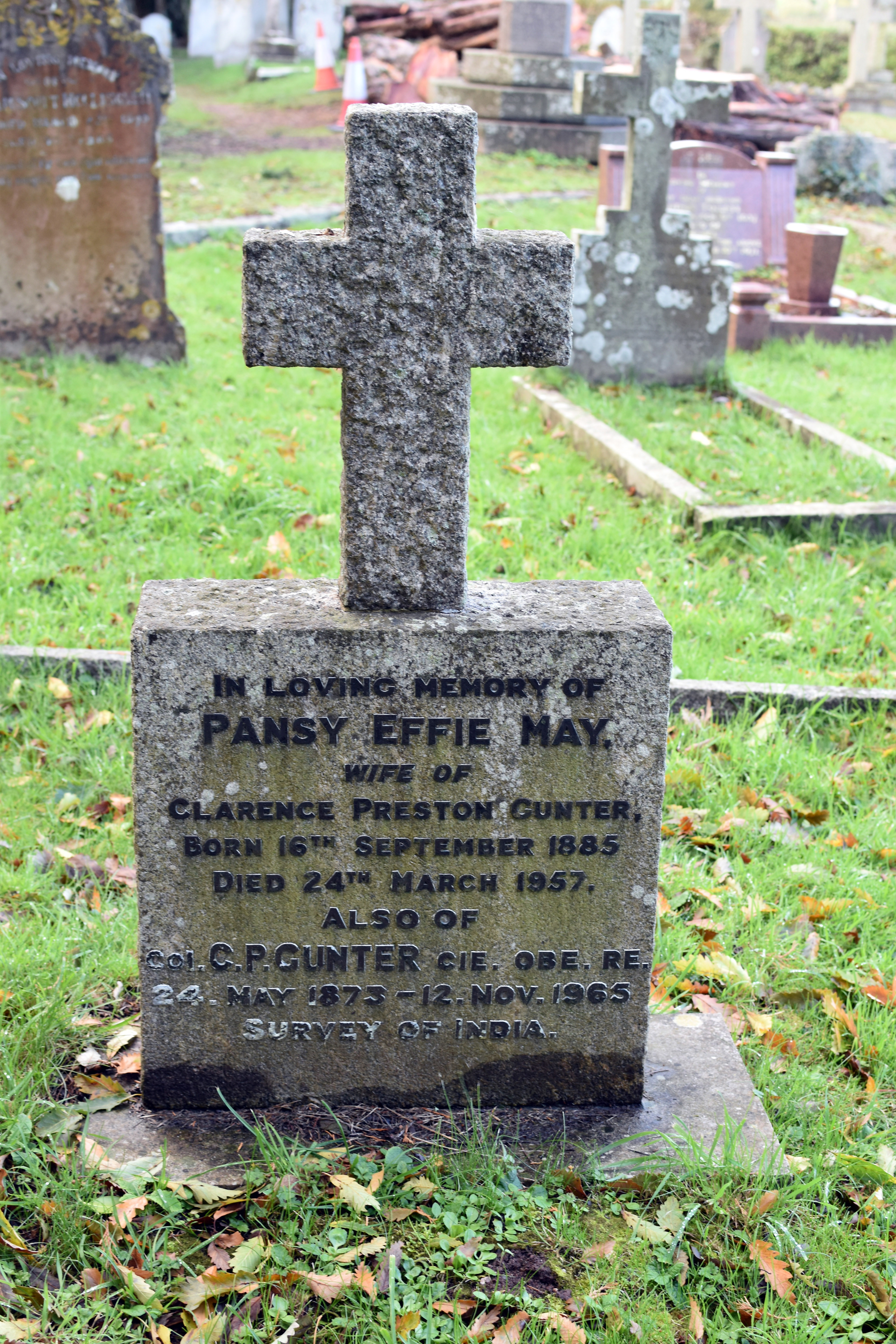
Today, Colonel Gunter is commemorated at St Clement’s Church, Powderham, Devon, where his grave lies beside that of his wife. The memorial stone, inscribed with his honours and his service in the Survey of India, stands in quiet contrast to the deserts of Mesopotamia where his innovations were forged. It is a fitting resting place: a parish churchyard overlooking the Exe estuary, linking the global reach of empire and war with the local rhythms of Devon life. His grave is not only a family memorial but also a marker of the moment when aerial photography reshaped the art of mapping, ensuring that soldiers and administrators alike could navigate the world with greater clarity.

