

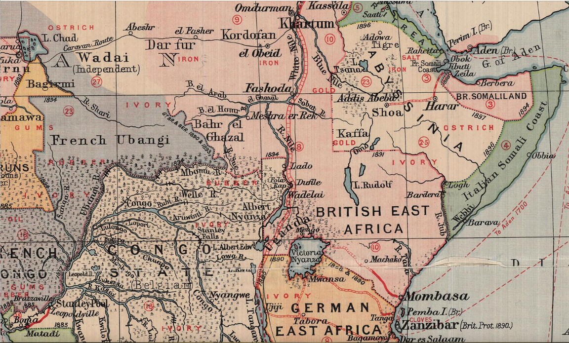
This map of east Africa was drawn at the height of the European colonial carve-up. Fashoda, the flashpoint of the Anglo French dispute in 1898 is in the upper central part of the map, below Khartum [sic]. The French Ubangi region, north of the Ubangi River, shows an undefined border with Sudan. The German claim to East Africa is in the lower part of the map, later to be captured from them in 1915 and named Tanganyika, later Tanzania. Italy at that time had to be content with the Somali Coast and Eritrea.

