

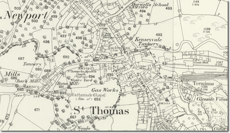
St Thomas parish occupies the lower ground north of Launceston’s hill, positioned along the River Kensey where the Augustinian Priory once dominated the landscape. The parish developed as a functional adjunct to the priory, providing labour, services and river‑side industry that supported the canons’ administrative and pastoral work. Its location below the castle and borough made it a natural site for water‑powered and water‑dependent trades.
The Augustinian Priory, founded in the early twelfth century, was the largest and wealthiest religious house in Cornwall. The canons operated hospitals, dispensaries and pastoral circuits, and they required dependable access across the Kensey to reach their estates and tenants. St Thomas parish grew around this ecclesiastical centre, with the church, bridge and river forming the core of its identity. The packhorse bridge provided the essential crossing point linking the priory precinct with the northern approaches.
The riverbanks at St Thomas became a centre for tanneries and related trades. Tanning required large quantities of water for soaking hides, washing, and disposing of waste. The Kensey’s steady flow and accessible banks made it suitable for these processes, and documentary evidence shows multiple tanneries operating here across the eighteenth and nineteenth centuries. These industries were labour‑intensive and often malodorous, and their presence reflects the parish’s role as a working zone outside the more elevated and prestigious borough centre.
The arrival of the railway in the late nineteenth century further altered the parish. Construction of the London and South Western Railway line required excavation and earthworks along the Kensey valley. During these works, labourers uncovered substantial masonry foundations belonging to the long‑lost priory complex. The discovery diverted attention from the railway project as engineers and antiquarians examined the remains. Only fragments were ultimately preserved, including the choir foundations now visible beside St Thomas Church.
The railway extension beyond Launceston reinforced the parish’s industrial character. Sidings, embankments and cuttings reshaped the landscape, and the line provided improved transport for goods produced in the area. Although much of the railway infrastructure was later removed following mid‑twentieth‑century closures, its role in revealing the priory’s footprint remains one of the most significant archaeological events in the parish’s history.
St Thomas parish therefore reflects a sequence of functional identities: ecclesiastical support zone, industrial riverbank, and railway corridor. Its connection to the priory shaped its early development; its tanneries defined its working character; and the railway works unexpectedly restored knowledge of the priory that had been lost for centuries. The parish’s landscape continues to show traces of each phase, linking modern Launceston to its medieval and industrial past.

