|
When I arrived at Survey of Kenya in early 1958 I was pleasantly
surprised to find an agency well set up and able to provide a full
topographic mapping service from aerial survey through photogrammetry,
cartography, photo-processing and lithography. In its modern FHQ at
Ruaraka, Survey of Kenya also had a technical Training Wing and a large
African Lands Division devoted to mapping consolidated plots of
fragmented African rural land under the Swynnerton Plan. Also, a special
cartographic group were working on the new Atlas of Kenya.
The Director, Administration, most surveyors, the plan registry, cadastral
services, city and township mapping and liaison with the adjacent Lands
Department were still housed in the old HQ colonial-style buildings in
what was then Government Road, where I spent my first six months
initiating a new 1:250,000 scale cadastral series. One day a column of
siafu, safari ants, rose through the cracked flooring and crossed the
drawing office floor as a solid brown mass before disappearing down
another crack. The aged electrical system provided a sharp tingle every
time a desk lamp was touched. Through my window I looked along
Kingsway with its Italian grocery, regularly visited by white-clad nuns who
emerged with laden kikapu to feed the hungry waifs they had rescued
from Nairobi streets. My Pakistani staff daily introduced me to a wide
variety of delicious koftas, pakorhas, and samosas, ("come on, sir, you try
that thing"). I was far away from the rather staid Kiwi environment and
loving every minute of it.
At FHQ the principal task of topographic mapping had, some years
earlier, been beefed up in response to greater needs by the police, the
military and government agencies during the Mau Mau Emergency. The
89th Field Survey Squadron, R.E., carried out topographic fieldwork in
remote areas, provided our printing presses and also ran the large map
and paper store. There were also a number of DOS (Directorate of
Overseas Surveys) surveyors attached, engaged in essential baseline
and triangulation surveys needed to establish an accurate geodetic
network and in control surveys for aerial photography.
In late 1958 when I was posted out to FHQ there were still very large
slotted-template laydowns to establish control and rectify the scale errors
of the aerial photographs, a technology soon to be superseded.
The 1:50,000 scale, SK 11 or Y731 topographic series covered the more
settled areas of the Highlands, Rift Valiey and Coastal region with over
250 sheets printed, by that time, in five colours. The 1:100,000 Y633
series, covering sparsely-populated areas such as the Northern Frontier
District, were basically tactical maps showing motorable terrain, roads
and tracks and had form-line contours. By then about half the 186 sheets
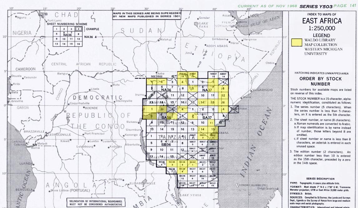
were printed. The 1:250,000, Y503 series, which I began in late 1958,
were derived from the 1:100,000 Y633 series. Designed for land
operations, they proved very popular with the Police Air Wing.
The large Atlas of Kenya, with 47 colour plates, was first issued in late
1959. It immediately sold out and I was tasked with producing a Second
Edition. A remarkable feature was its complete design, compilation,
drawing, printing and binding within Survey of Kenya without the
overview of a committee of academics, as is the norm.
The SK 13 and 14 1:2,500 and 1:5,000 Nairobi and Environs topocadastral
series, totalling 136 sheets in five colours, showed cadastral
boundaries overprinting topography, revealing some glaring suburban
land encroachments. Many other townships were also covered. There
were cadastral maps of Nairobi and Environs at 1:25,000 and Settled
Areas at 1:50,000, plus other municipalities at 1:10,000 scale. Aerial
photographs were also available for purchase.
A large range of special maps, at scales of 1:1,000,000 to 1:4,000,000,
included mean annual rainfall and rainfall probability maps, hunting block
maps, a folding safari map, administrative boundaries, the Nairobi Area,
Nairobi Royal National Park and Mt Kenya maps. There were some 'oneoffs'
such as Famine Relief maps to aid in combatting the severe early
'60s drought.
Production of such a large array of topographical, cadastral, township
and miscelianeous maps, plus a large Atlas, required complex planning,
massive expenditure and great dedication by all those involved. This
huge effort reflected great credit on the colonial administration's foresight and resolve. Maps are essential in any country's development and must
be accurate and of good quality. Achieving this, using the pre-digitai
technologies of the day, required a large staff and the combined efforts of
a number of disciplines: the aircrew who flew the vast areas of accurate,
overlapping aerial photography; the land surveyors who provided
baseline measurement and primary triangulation essential for an
accurate geodetic framework, also ground control surveys; the
photogrammetrists who plotted the map detail to scale; the cartographers
who compiled and produced the final fair drawings; the experts who fieldchecked
for detail accuracy and incorporated accurate nomenclature; the
lithographers who processed and printed the maps and, lastly, the map
librarians who saw that the latest editions quickly reached the hands of
those who relied on them.
Survey of Kenya's training of local recruits of all races in these complex
and exacting technologies also reflected the vision displayed by the
colonial government. I must admit, in coming from the New Zealand
Lands & Survey Department, I had not expected to find African
cartographers capable of the most complex mapping work with minimal
supervision. Their cartographic standards were up with the best and their
work ethic certainly superior. In the late '50s I imagined I had a long and
enjoyable career ahead in Kenya.
From its earliest days Survey of Kenya had to surmount huge difficulties
in distance, hostiie environments, slender resources and sometimes
danger to establish a viable cadastral system on which title could be
issued and a reliable geodetic framework on which topographic mapping
could be carried out. There were also five international boundaries to be
surveyed and demarcated and internal administrative boundaries which
had to be legally defined. On this note, one of my interesting tasks
nearing Independence was the defining of proposed regional boundaries.
In mid-1963 the Director and I went into lock-up mode to define and
legally describe these post-Independence regional boundaries only to
have them scrapped after all our exacting work was completed. I
sometimes wonder whether regionalism would have benefited or
complicated Kenya's subsequent development.
In late 1963 I left for home and today have lasting memories that those
were the most challenging, interesting and rewarding of my forty years in
cartography.
|