

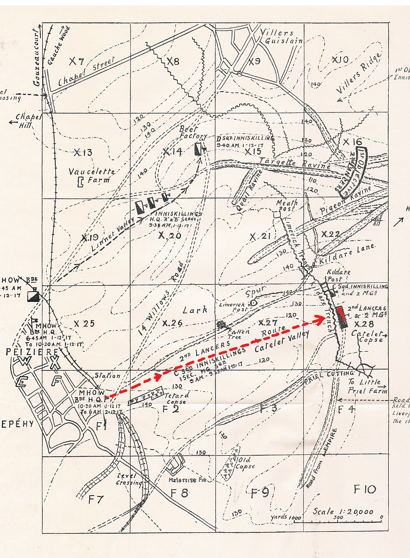
The area of the map is about 15 miles southwest of Cambrai. The town of Epéhy is linked with Peiziere. Just to the north of the town the position of the Mhow Brigade is marked as 6.45am 1 Dec 1917. They moved to the southeast of the town and at 9 am galloped the 2 miles east through Catelet Valley to Kildare Trench. They were fired at from Limerick Post on their left as well as from Kildare to their front.
This map was reproduced in the Cavalry Journal no. 67, Jan 1928 to accompany a detailed account of the battle on 1 Dec 1917. The obscured notes on the right are, 1st Objective, Inniskilling Dgns with an arrow to Villiers Ridge. Lower down, an arrow shows the direction of Honnecourt. The lower note points to 'Road in cutting held by 1/6 King’s Liverpool Regt of the 155th Brigade'.

