|
|

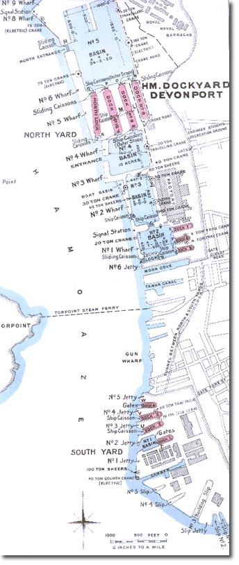 |
| This map sees the dockyards in pretty much their peak size and spread. New basins and docks had been built that would allow the new battleships and dreadnoughts to be built. You can see clearly that the North and South Dockyards were physically separate from one another. The South Dockyard was the original Plymouth Dock, but more room had had to be found to expand the docks and these could only be found North of the existing site. The two docks were connected by a tunnel. |
Empire in Your Backyard: Plymouth Article
Armed Forces | Art and Culture | Articles | Biographies | Colonies | Discussion | Glossary | Home | Library | Links | Map Room | Sources and Media | Science and Technology | Search | Student Zone | Timelines | TV & Film | Wargames
