|
A significant early development in British Colonial Africa was the
establishment of geological survey departments in each of the territories.
The role of these organizations was seen mainly at that time as providing
support and control of mineral exploration and the development of
groundwater resources.
In the summer of 1952 I graduated as a geologist, and was then appointed to
the Colonial Service with a note that I was assigned to Uganda. My first
posting in Uganda was to Karamoja district lying on the northeast side of the
country. So, equipped with my as yet untested degree in geology, I was to be
the first to conduct systematic geological mapping of the Precambrian terrain
in the northern region of Uganda. Three weeks after arriving in the country, I
was on my way with Richard McConnell, the department's Assistant Director,
to the small administrative centre of Moroto to start the project. Moroto
township lies at the foot of a volcanic mountain of the same name, and was at
that time staffed by about a dozen or more British and other officials and
professionals, some with wives and young families. And it had a small
swimming pool fed by the cool mountain waters.
After introductions with Sandy Field, the District Commissioner, I familiarized
myself with the administrative and other facilities, and recruited a local
Karamojong "headman" to accompany me on traverses and look after my
porters. After making some traverses around the foot of the mountain to
familiarize myself with the terrain I set up a campsite dominated by a huge
shady fig tree some twenty miles from Moroto from where I conducted my
geological traverses.
During the Karamoja project I would spend as much as eight or nine months
in the year geologically surveying the terrain. For this I would set up itinerant
camps in various places as the mapping proceeded. I recruited porters locally
to carry loads and act as guides. At first we traversed where there was easy
access from motorable roads. In places devoid of such roads, we travelled
"missionary style", with loads carried on the porters' heads, or on the backs of
donkeys. Periodic spells back from the field in the Entebbe office would be
spent on laboratory work and writing reports.
The country I first mapped in Karamoja was of fairly low relief, and I soon
discovered that one of the best places to find rock outcrops was in the
meandering river valleys. One day we almost walked into a leopard as we
rounded one of these stream meanders. Another day I was bitten by a
scorpion which fell down inside my shirt, and I was languishing on my bed recovering when my Director turned up for a visit. I also soon learned about
termites when they ate the leg off my pants which were touching the ground
over a chair.
An outstanding early trip was when I accompanied cattle buyer Wreford Smith
from a farm in the neighbouring Kenya highlands who would periodically visit
Karamoja to purchase cattle from the local tribesmen. Most evenings there
were excursions hunting guinea fowl and small antelope which would be
added continuously to the curry pot for our evening meals. In return for his
hospitality, and the opportunity to absorb his bush wisdom, I examined and
reported on a number of small mining properties which he held in the district.
My daily accoutrement on these traverses included a geological hammer with
which to break off samples, carrying bags, my lunch and drink, a notebook, a
base map mounted on a board, and aerial photographs used to aid in
pinpointing location. Geological observations made at rock outcrops were
pencilled in on the base map, or in some cases on tracings laid over the aerial
photos. In the evenings or on rainy days I would transfer the data to base
topographic maps, which we were fortunate to have available at that time.
I soon developed a one-on-one relationship with the Karamojong men -
typically friendly and curious about what we were doing, some perhaps
grudgingly accepting of me, some if only peripherally engaging and who
deferred to me up to a point. The Karamojong were pastoralists and some of
the men were willing to work with us as porters and guides in the bush, as
essentially it seemed, for the experience as much as for the meagre pay and
a daily allocation of white cornmeal ("posho") and perhaps some tea. In
communicating with the local people I soon began to grasp the lingua franca
Swahili, and even the Karamojong language.
A vital consideration in choosing a campsite was the availability of water,
which we often found during the dry season in the riverbeds. In response to
the need for access to clean water sources in the rural areas the department
provided geological expertise in the choosing of drill sites for the construction
of water wells. The water from the drillings is obtained from fissures in
bedrock at relatively shallow depths. The wells were, and probably still are,
fitted with hand pumps for use by the local population. The drilling programme
was supported by a fleet of borehole maintenance units servicing the wells
throughout the country.
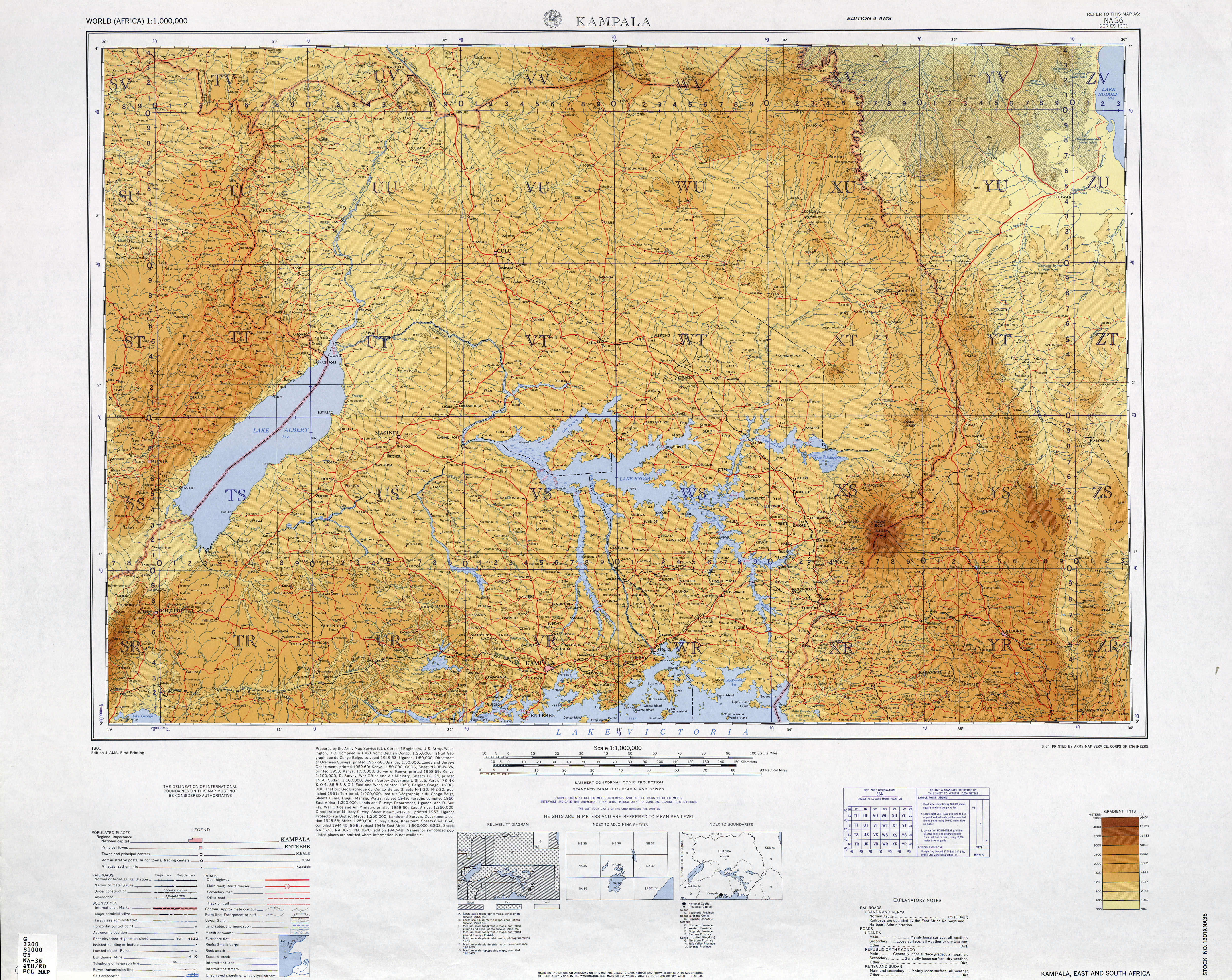
After working in Karamoja I was transferred to West Nile district in northwest
Uganda where I spent five years geologically mapping Precambrian rocks and
younger sedimentary infill along the Albertine Rift Valley marking the western
border of Uganda and up to the then Belgian Congo and Sudan borders.
Together with my colleague John Hepworth who was mapping alongside me
in the same district we brought to light some of the oldest Precambrian rocks then known to geological science. I was fortunate in being able to use data
from this work towards the award of a Ph.D. degree at the University of
London.
I was then moved to work on a mapping project along the beautiful coastline
and islands of Lake Victoria in southeastern Uganda. This project was
terminated abruptly when I was called a month before Uganda's
independence to take care of the department's geological mapping and water
drilling programmes as Principal Geologist. After being engaged in this for
about six years I was appointed founding professor to a new Department of
Geology at Makerere University in Kampala. Although no longer a colonial
employee, my stipend was augmented in both positions with a British salary
supplement.
|